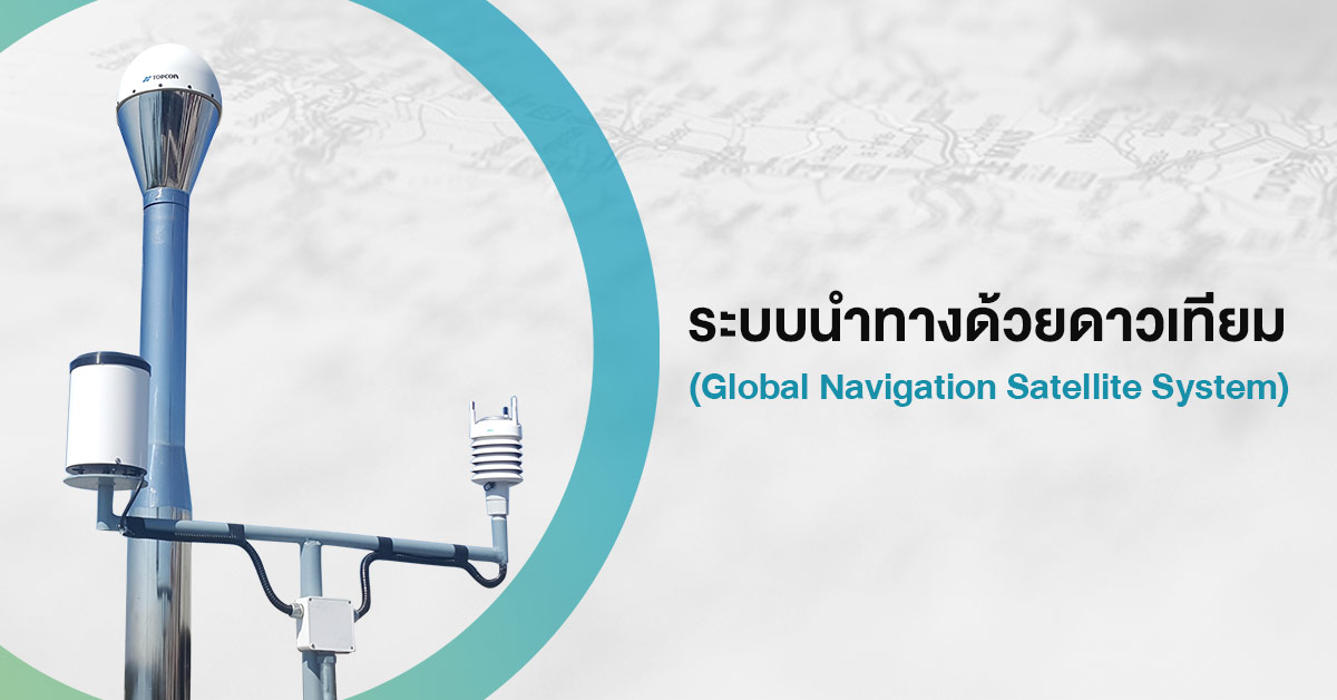
Network Real Time Kinematic for National Development
23/04/2020
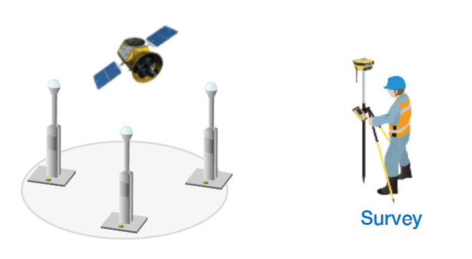
National development needs geographic information or data map which is precise and up to date. Developed Countries already use GNSS: Global Navigation Satellite System by using GNSS Continuously Operating Reference Station or GNSS CORS for the horizontal and vertical coordinates service with high accuracy.
The installation of GNSS CORS receiver in Thailand has been installed and serviced at Department of Lands, Department of Public Works and Town and Country Planning, and collaboration project between Department of Disaster Prevention and Mitigation, National Institute of Metrology (Thailand) and Hydro – Informatics Institute (Public Organization). 80 additional stations are underway by Royal Thai Survey Department. In 2019, total 285 GNSS CORS receivers will be ready to operate nation-wide to provide continuous positioning and timing information.
The responses from the GNSS CORS navigation system transmits a spatial data with high precision such as coordinate, datum level, atmospheric and satellite orbit details. These data can be used for lentiful task such as survey system, data support for the development planning and researches.
Compared to the original navigation systems, the GNSS CORS takes 4 times less, explore up to 800 points per day, 4 cm. accuracy, and save cost to 45% from the original system. It can build on national important development plans such as cadastral survey, high precision mapping, supporting agricultural research, transportation & shipping, resource and disaster management, and etc.
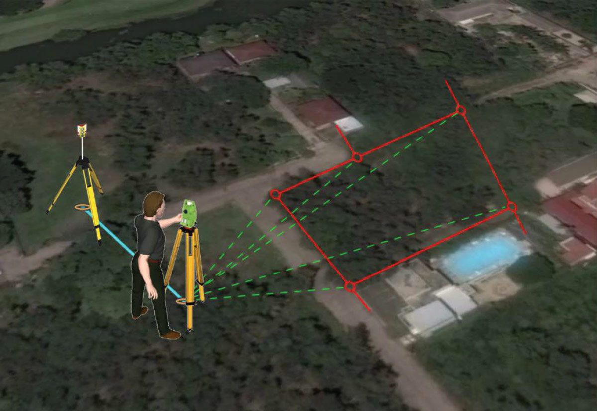
The Application for Highly Precise Cadastral Survey
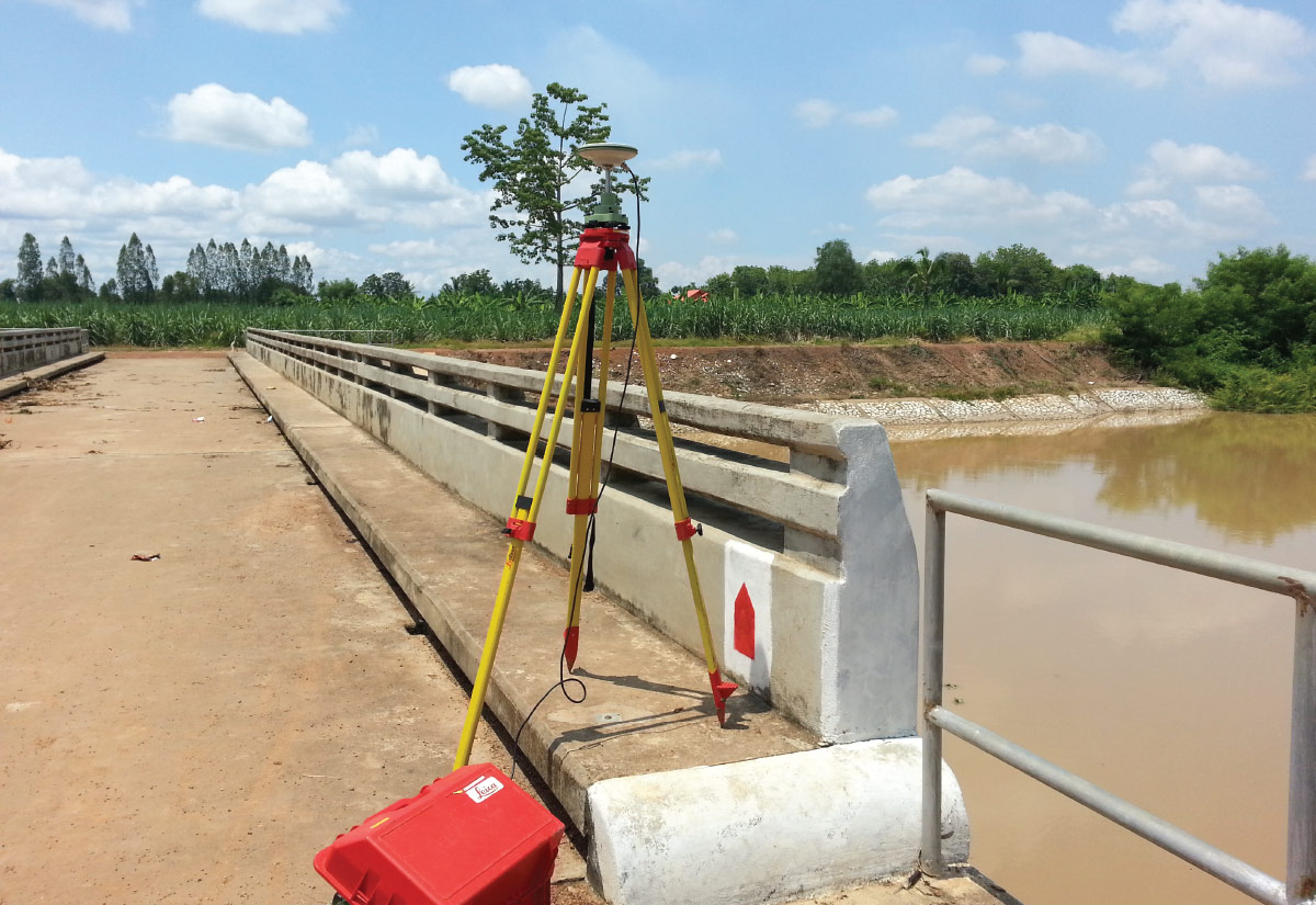
GNSS CORS was defined as a new technology in Thailand, most commonly used for cadastral survey because of its high accuracy, survey speed, less devices and less manpower. Recently, the usability of GNSS CORS systems in Thailand is often used to refer to coordinates, datum level and mostly in cadastral survey which reduce working time, number of staff, surveying budget but receive more precise results than the original navigation method e.g. mapping control, cadastral survey, surveying for mapping, planning for design of construction, public utility survey, resource survey and etc.

The Application for Precision Mapping
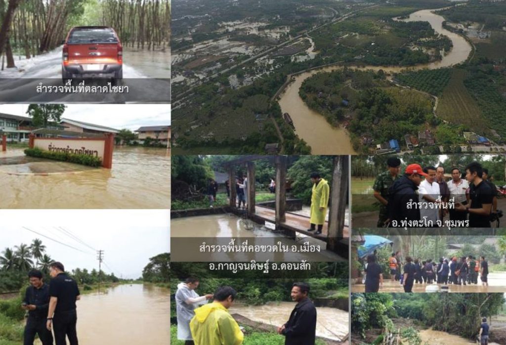
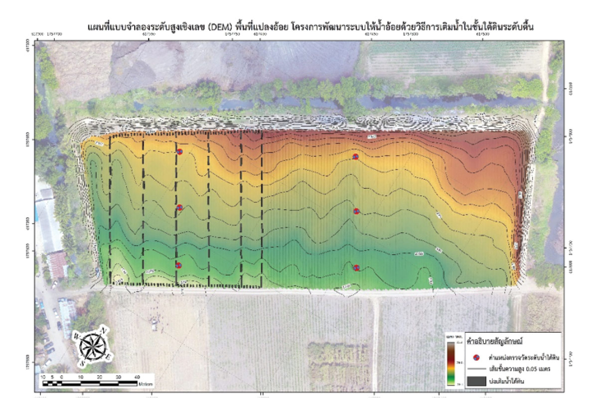
For effective national development plan, a highly accurate and reliable map is vital as a decision-supported information. And the accuracy of these mappings were depended on the accuracy of its surveying. The application of GNSS CORS together with the spatial survey can be accomplished fast and accurate. With precise data, it can promptly produce map during emergency situation e.g. mapping of disaster risk area for future risk reduction plan.

The Application for Research Support
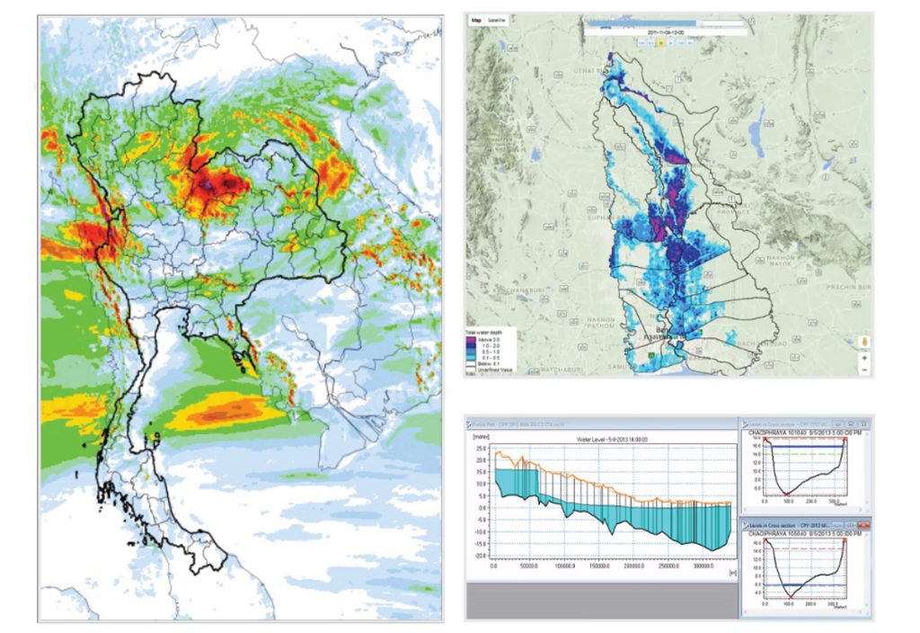
Datum level and atmospheric datasets from GNSS CORS can be applied for water volume and humidity calculations. This data supports and develops the weather and flood forecasting models which show a close-to-reality result. Therefore, the usability of both protection and reduction plans or management in various basins become not only effective, but also promptly and precise.
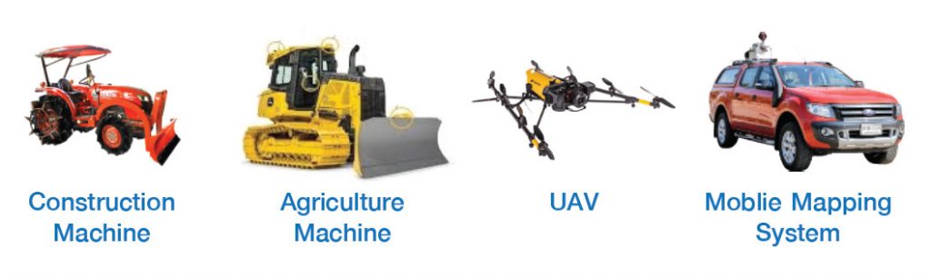
The Application for Agriculture
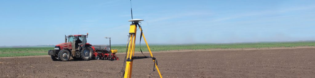
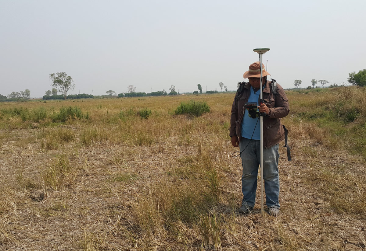
Precision agriculture now becomes outstanding since the agricultural machine has been automatically controlled by GNSS CORS system e.g. cultivation (sowing), growth tracking (irrigation and fertilization), and harvesting. This machine can be moved accurately, reduce farm products damages, save time in each agricultural process, save equipment and labour cost. Consequently, the total cost of production is also decreased.

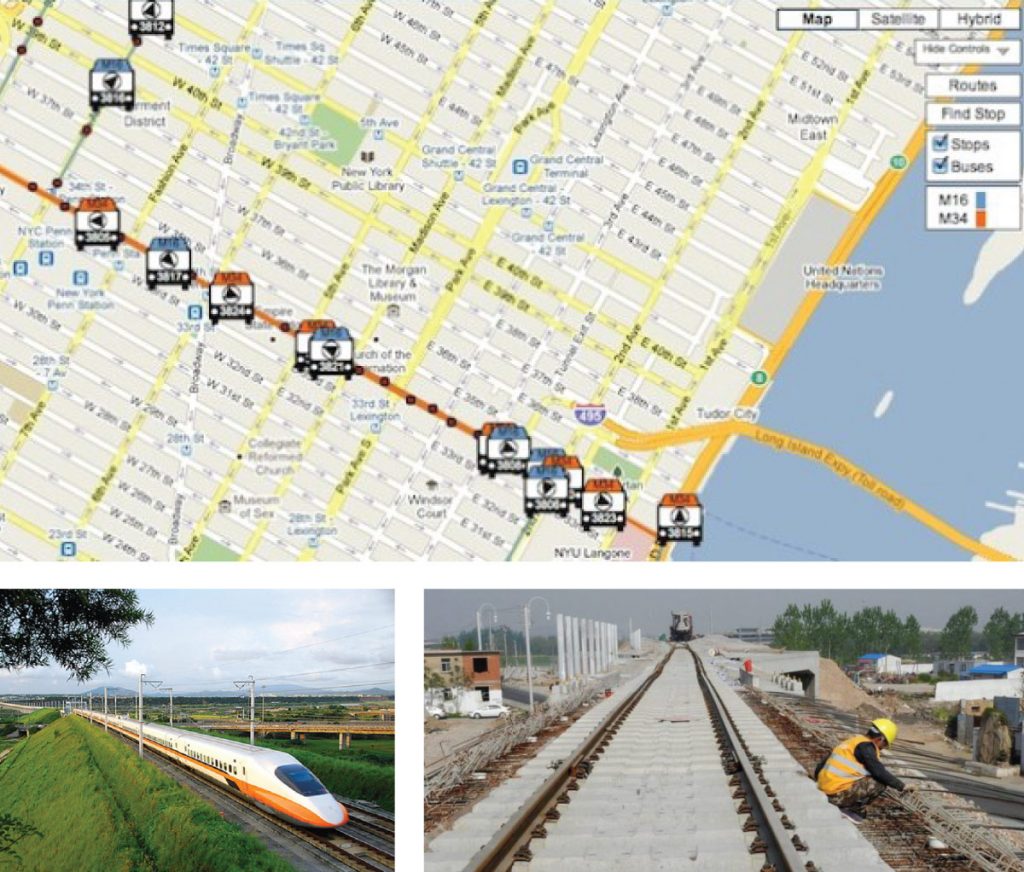
The Application for Transportation and Shipping
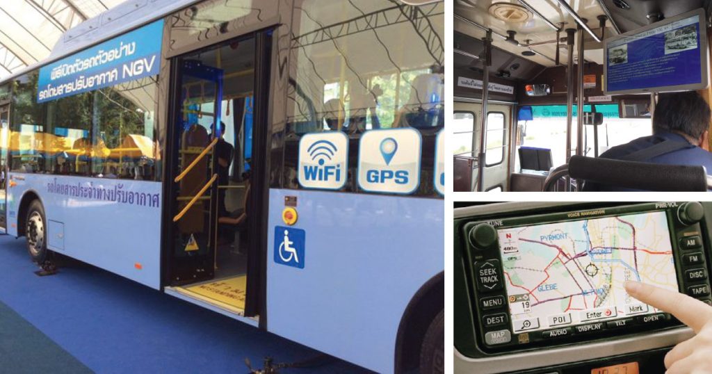
GNSS CORS can be effectively applied for the transportation and shipping system e.g. accurate and fast horizontal route survey, making all procedures faster. Besides, GNSS CORS can be also applied for companies logistics to precisely track goods transportation. GNSS CORS has also been applied for new Thai transportation model such as high-speed rail which need high accuracy of route surveying.
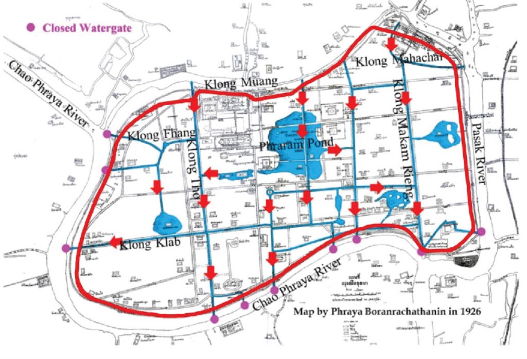
The Application for Resource management and Disaster Management
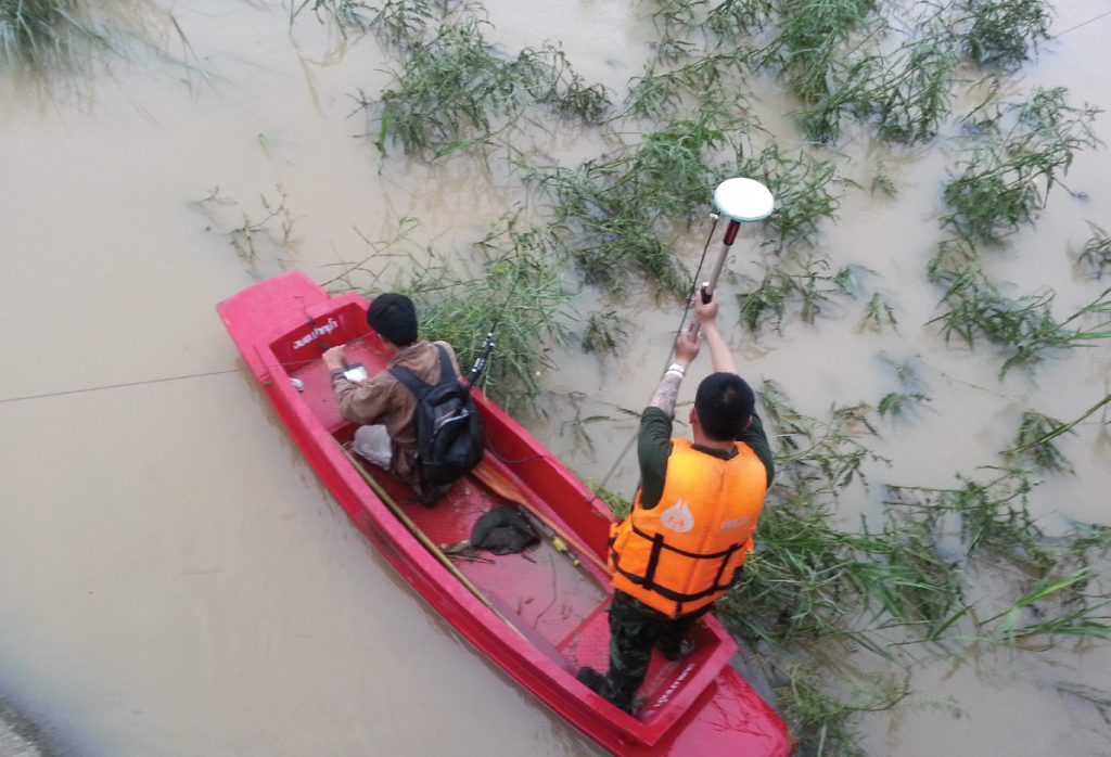
Natural and environmental knowledges are major factors affecting directly to national development in economic, social and cultural. Natural resource management is therefore an important issue for the government. GNSS CORS is also one key method to manage resource datasets. It can conveniently, quickly, and immediately provide accurate and reliable results e.g. monitoring the movement of earth crust, disaster monitoring, land usage planning, zoning for prevention of forest encroachment and depletion, and etc.
GNSS COR can also be used in crisis and disaster management by accurately define the position for disaster notification, evacuation route planning, assistances and others, which is a great way to increase the efficiency of the search and rescue operations team.