Operational Storm Surge Forecasting System
22/04/2020
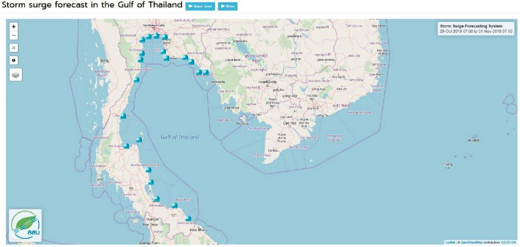
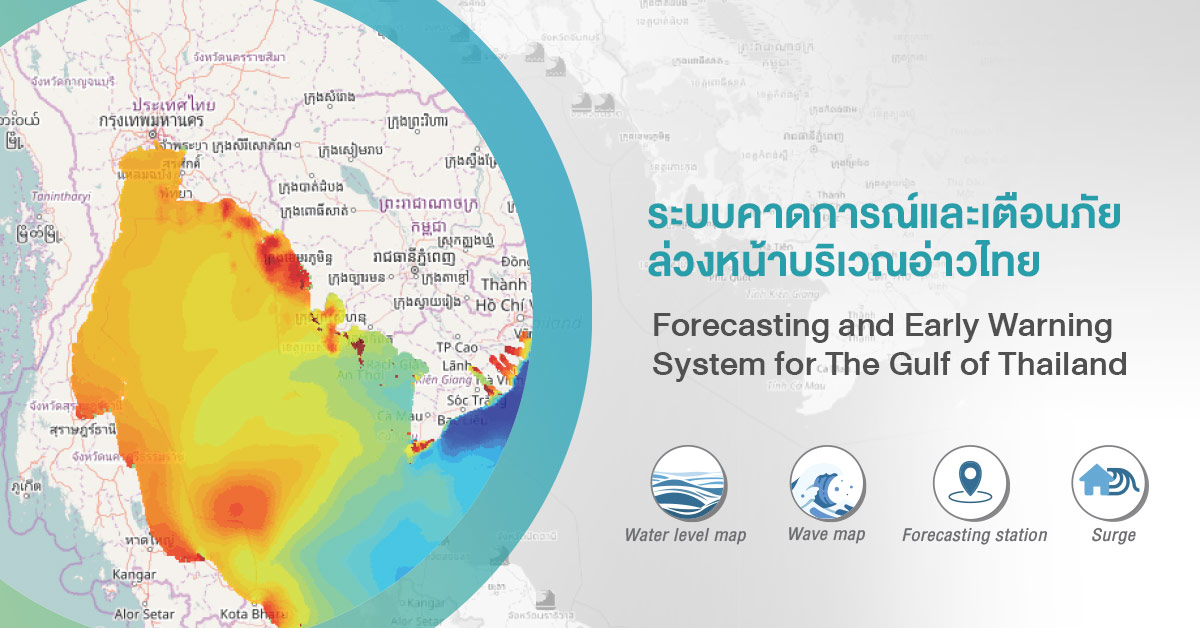
Forecasting and Early Warning System for the Gulf of Thailand consists of following models:
- The Delft3D Flexible Mesh hydrodynamic model (Delft3D FM)
- SWAN wave model
The operational platform is based on Delft- Flood Early Warning System (FEWS), can be used to support a decision-making process, impact assessment and help to reduce coastal disasters more efficiently and robust
All the models are controlled by Flood Early Warning System (FEWS) which support for data input preparation and the visualization of model output. This model shows 3-day forecast level of tidal, wave, and surge. The model can be used to support a decision-making process, impact assessment and help to reduce coastal disasters more efficiently and robust.
Tropical storm Pabuk lashed in southern Thailand
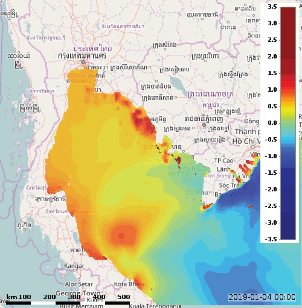
Water Level Map during Tropical Strom Pabuk 
Wave Height Map during Tropical Storm Pabuk
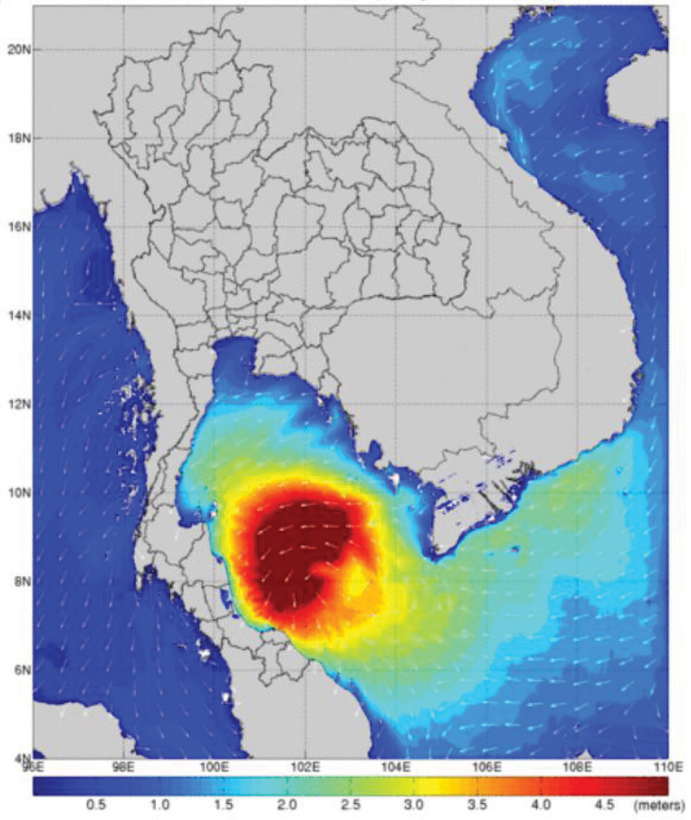
Storm Surge Forecasting during tropical storm “Pabuk” in January 2019, water level rise from 1.5 – 2.5 m. height wave was discovered all over the Gulf of Thailand. The situation was reported to the Department of Disaster Prevention and Mitigation to issue early warning in high-risk areas. People were evacuated and prepared to handle the storm surges on time and consequently reduced losses of life and properties.
The verification was actives after the Pabuk was gone to compare between the prediction and the water level from measurement. The model prediction was found over 60% accurate which showed the model can be applied for decision-making during emergency situation.