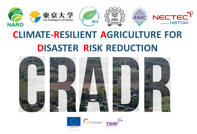
CLIMATE RESILIENT AGRICULTURE FOR DISASTER RISK REDUCTION - CRADR
08/01/2021
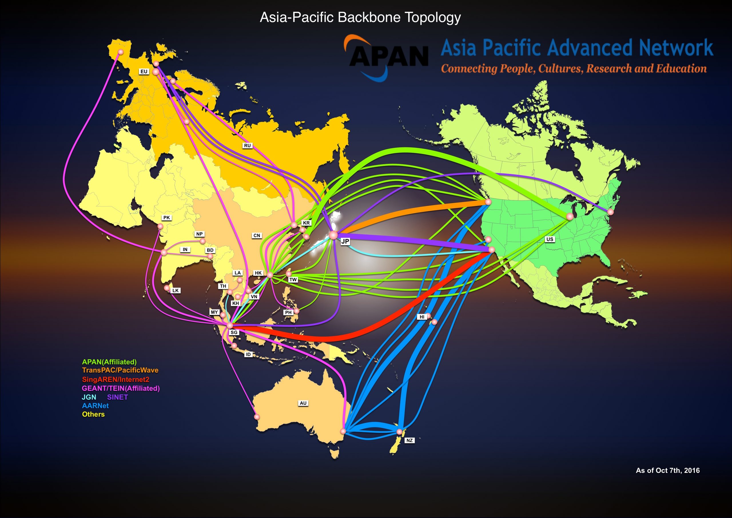
Background: CRADR is a project funded by the European Commission. The project was collaborated between Disaster Mitigation Working Group (DMWG) and Agriculture Working Group (AgWG), under the Asia-Pacific Advanced or APAN network which linked between members of research agencies and educational institutions from all over the world. The project aims to study climate change affecting agriculture on a small scale case study (Phrae Province), then learn and adopt modern technologies transferring by ‘Partners’ from various countries e.g. Japan, Taiwan and India to solve the climate resilient problems and develop this area into ‘Smart Agriculture’. Moreover, the project will be participated and shared among ASEAN members so that each country can study and adopt the outcome from this project to deploy in their own country.
Supporter : TEIN*CC under the authority of European Commission
Objective: CRADR aims to study climate change affecting agriculture on a small scale case study (Phrae Province), then learn and adopt modern technologies transferring by ‘Partners’ from various countries e.g. Japan, Taiwan and India to solve the climate resilient problems and develop this area into ‘Smart Agriculture’. Moreover, the project will be participated and shared among ASEAN members so that each country can study and adopt the outcome from this project to deploy in their own country.
Participant: 190 participants/trainees from 12 countries: Cambodia, India, Indonesia, Japan, Lao PDR, Malaysia, Myanmar, Philippines, Singapore, Taiwan, Thailand, and Vietnam.
Project duration : April 2020 – April 2021 (6 months)
Participant: 190 participants/trainees from 12 countries: Cambodia, India, Indonesia, Japan, Lao PDR, Malaysia, Myanmar, Philippines, Singapore, Taiwan, Thailand, and Vietnam.

Partner consists of:
- Hydro-Informatics Institute (Public Organization)
- National Agriculture and Food Research Organization (NARO, Japan
- University of Tokyo, Japan
- Academia Sinica Grid Computing Center (ASGC, Taiwan
- Centre of Studies in Resources Engineering, Indian Institute of Technology Bomba, India
- National Electronics and Computer Technology Center (NECTEC), Thailand
CRADR Activity Plan

Outcome from the project
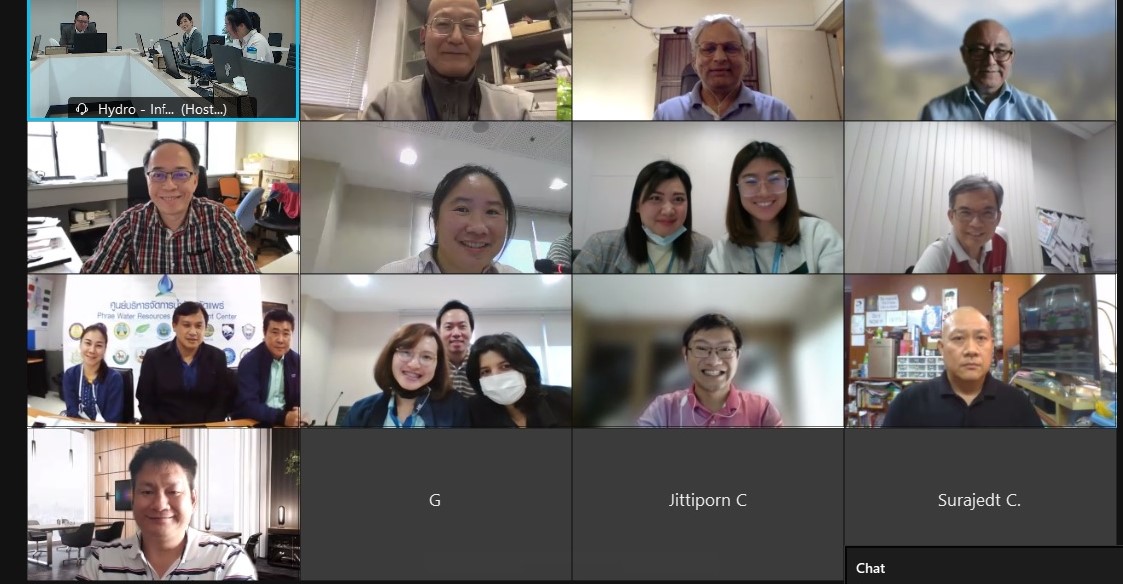
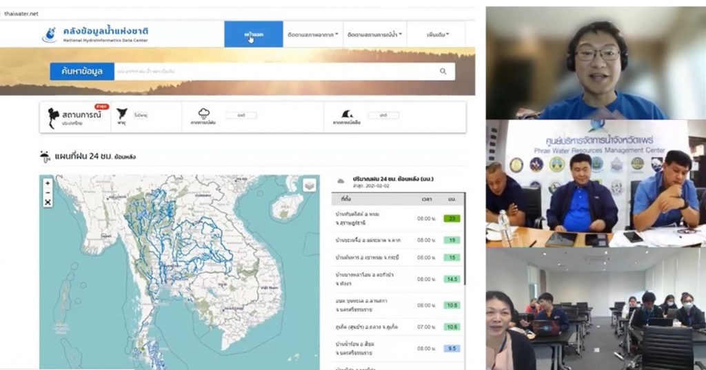
- Online Training of how to access and utilize District Real-time Information
Due to the outspread of COVID-19 which later led to domestic travel limitation in Thailand, therefore, this training was organized through online platform on 2 February 2021 by HII Thailand to introduce and indicate the source of existing tools and technologies with the small-group of 20 key participants from Phrae PWRM, relevant government agencies, and Happy Farm representative. The training focused on the usage of information to analyze Water Demand & Supply of Phrae Province, and the usage of using Flood and Drought Forecasting Models for water usage and cultivation planning of the local farmers. The District Real-time Information of the Phrae province can be accessed through the website of “Provincial Water Resources Management Operation Centre” (http://phrae.thaiwater.net) Phrae province which can be categorized into four main parts: Monitoring, Forecasting, Geoinformatics Information Systemn (GIS) and Statistics.
- The Evaluation of Meteorological Parameters Impact on Agricultural Production for Climate-resilience Agriculture (Fact finding)
HII has evaluated Phrae climate conditions by the meteorological parameters which can be divided as 4 categories as follows:
2.1 Rainfall analysis
The extreme indices which computed from daily observed rainfall data from Thai Meteorology Department and 5 CMIP6 global circulation model data included CESM2, MRI-ESM2-0, BCC-CSM2-MR, GFDL-ESM4, and CanESM with 2 shared socioeconomic pathways (SSP) The analysis can be summarized into 2 levels as follows:
Thailand
– Monthly rainfall tends to decrease in early rainy season (Mar – Jul), and while tends to increase in end rainy season (Aug– Feb)
– Annual rainfall tends to increase 2.25% to 6.02%.
Phrae province
– Monthly rainfall tends to decrease in early rainy season (Mar – Jul), and while tends to increase in end rainy season (Aug – Feb)
– Annual rainfall tends to increase 2.54% to 15.16%.
2.2 Extreme Climate
The extreme rainfall indices were analysed based on the daily observed rainfall. For Thailand, it was found that the extreme rainfall indices consisted consecutive wet days (CWD) 31.65 days, consecutive dry days (CDD) 71.89 days, very heavy rainfall days (R30mm) 6.15 days, max 1-day rainfall 84.12 mm, max 5-day rainfall 172.12 mm, annual contribution from very wet days (R95pT) 0.28, and simple daily intensity index (SDII) 8.32 mm/day.
2.3 Agriculture Effect
The predicting crop yield and crop losses (2015 – 2039) was focused on major rice, second rice, and maize. In the near future (2015 – 2039): Crop yield of major rice tends to increase 3% in SSP245 and 1% in SSP585, Crop yield of second rice tends to decrease 13% in SSP245 and 31% in SSP585, Crop yield of maize tends to increase 1% in SSP245 and decrease 7% in SSP585.
Crop losses of second rice tends to decrease 41% in SSP245 and 50% in SSP585, possibility of occurrence 56% in SSP245 and 60% in SSP585. Crop losses of maize tends to decrease 36% in SSP245 and 38% in SSP585, possibility of occurrence 52% in SSP245 and 56% in SSP585.
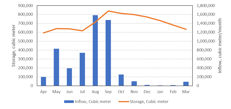
2.4 The Water Balance Analysis of Huay Pom Reservoir
To find out the water sufficient in this area and the future water balance of the reservoir would be analysed based on the rainfall, maximum and minimum temperature of GCM data. The storage of reservoir has slight change but decrease May to July significantly. Although the water deficit effect to the cultivation slightly, the farmers might avoid to cultivate the plants at the early wet season (May to July) due to lower storage in the future.
- The Evaluation of Science, Technology, and Innovation for Climate-Smart Agriculture at the Case Study Area
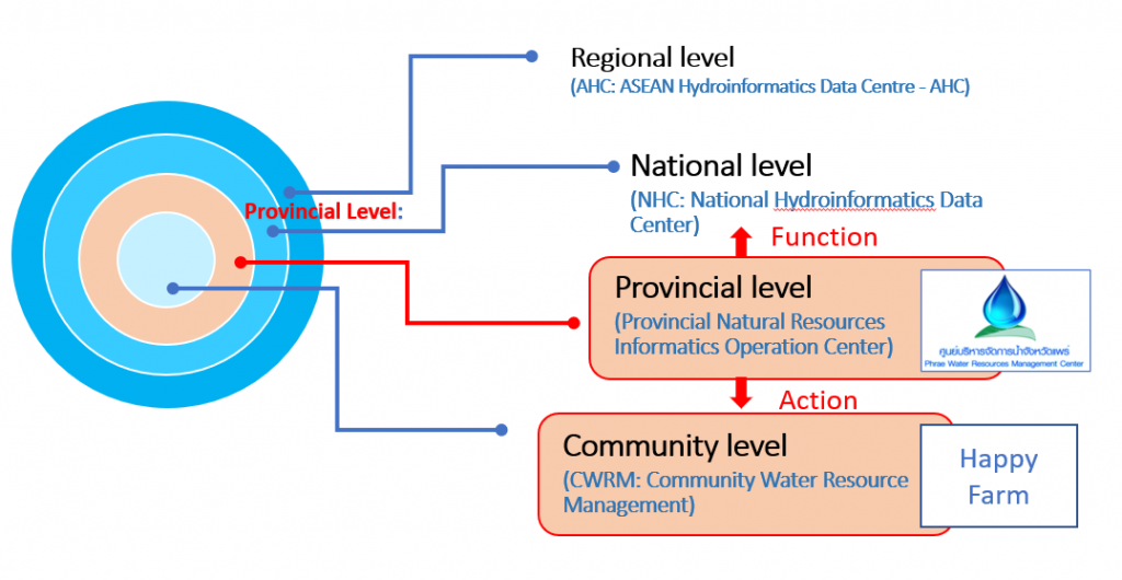
Weather and water data are the basis for forecasting the weather situation, planning on water management planning and supporting decision-making to be more accurate and efficient. The implementation of the CRADR project can lead to the integration e.g. science, technology and innovation to create a smart farming model under climate change. Starting from the National Level or the National Hydroinformatics Data Center (NHC: National Hydroinformatics Data Center), which can be the major system that the provincial level water center can use such data to analyze and plan local farmings, especially warnings disasters to the community (Community Level), which is considered to be those who apply the data to adapt in their agriculture in order to reduce the loss productivity.
Future Collaboration
HII has set up the “The principle” of the interoperable development for future sustainability can be divided into 3 phases, Standard, Advance, and Professional. The stakeholders in the project can be classified in 3 perspectives, Community, Province, and Supporter (Related working group e.g. ASGC, UT, NARO, IITB, HII and other related agencies).

Moreover, Working Group has planned the future plane pf CRADR on 2nd phases to increase the potential of the case study area with suitable technology together with international working groups. The goal is to develop a study area (Phrae Province) as an good practice to expand across ASEAN in the next phase.
Full report can be download here