Ayeyarwady Integrated River Basin Management project – AIRBM
29/10/2020
1. Background
In 2014, the World Bank has allocated a budget of 100 million US dollars to the Republic of the Union of Myanmar for the Ayeyarwady Integrated River Basin Management (AIRBM) project. For better integrated water management of the Ayeyarwady River Basin, the project has been divided into 3 main parts; Organizational structure, Database integration, and Improving watercourses for navigation.
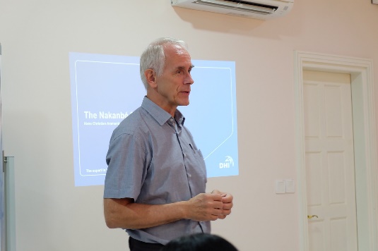
In 2016, the World Bank invited ‘Hydro – Informatics Institute (HII)’ to pass on knowledge and experience on the development of Hydro-Informatics Center (HIC) to the AIRBM project. HII had jointly organized 2 workshops titled “From data and information to planning” to the relevant officers from the Republic of the Union of Myanmar.ฺ Both parties eventually agreed that effective water management requires more knowledge and technologies hence the cooperation should be continued in the future.
During 2018-2023, HII, as a sub-consultant of DHI A/S, started the Ayeyarwady Integrated River Basin Management (AIRBM) project section ‘C1.17 Development of the Ayeyarwady Decision Support System and Basin Master Plan in the 1st Component: Water Resource Management Institutions, Decision Support Systems and Capacity Building’. With an objective to develop tools for decision support on water resource management in the Republic of the Union of Myanmar, integrated water resource management of the Ayeyarwady River Basin, and support training for officers from water management fields in the Republic of the Union of Myanmar.
2. Operation
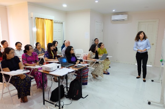
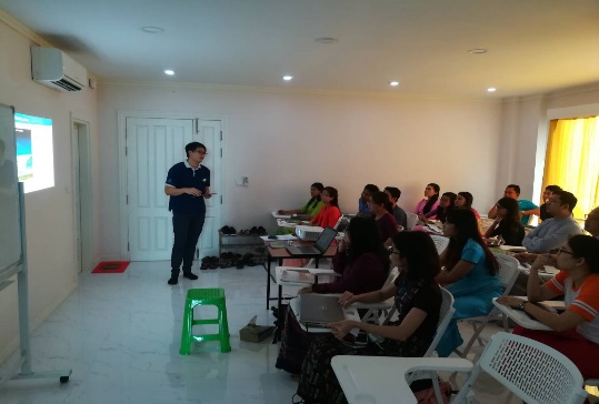
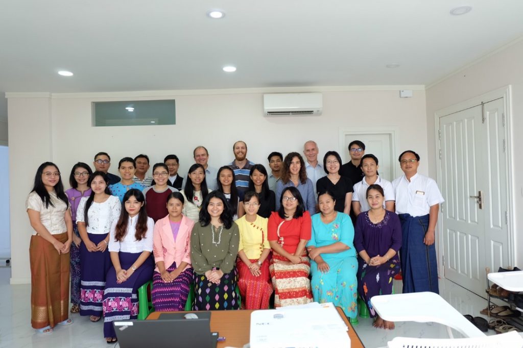
Under the Ayeyarwady Integrated River Basin Management (AIRBM) project, HII and DHI had organized the following activities in Yangon, Myanmar:
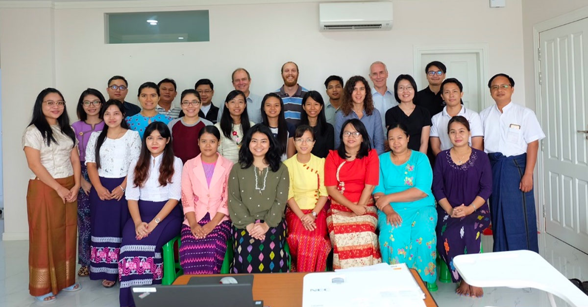
2.1 During 3 – 14 September 2018, co-organize a training on the usability of the Rainfall-Runoff and River Basin Modeling models. The event was hosted by experts from HII and DHI with 20 participants in the training.
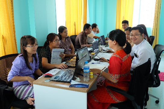
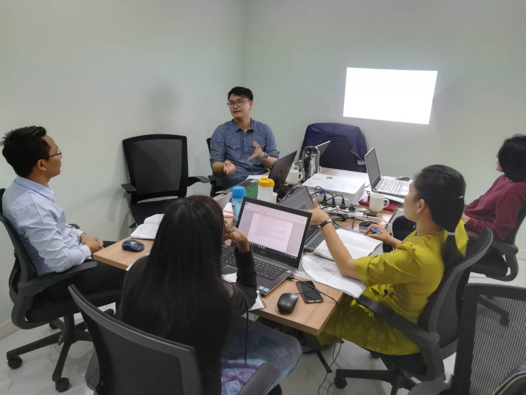
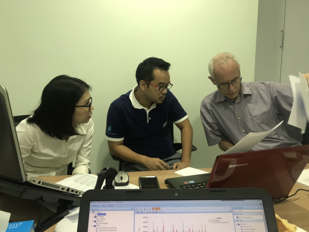
2.2 The 1-dimensional Hydrodynamic Modelling training which has separated into 2 courses; the 1st course on 7-16 November 2018 and the 2nd course on 15-18 January 2019. In this activity, DHI invited HII’s experts on modeling to transfer the knowledge and experiences to 18 participants.

This training was organized for 8 Myanmars’ agencies related to water resources management as follows:
1) Hydroinformatics center, Ayeyarwady Integrated River Basin Management (HIC)
2) Department of Disaster Management
3) Department of Meteorology and Hydrology (DMH)
4) Directorate of Water Resources and Improvement of River Systems (DWIR)
5) Mandalay Technological University
6) Myanmar Maritime University River & Coastal Department
7) Yangon Technological University
8) Department of Hydro Power Implementation (DHPI)
The project has broaden HII’s reputation on the success of water management to the international level. The project has also raised the capacity of HII’s experts on training capability and disseminated HII’s model development and decision support system for water management in Myanmar.
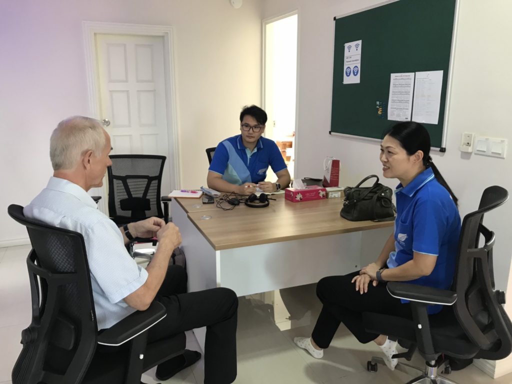
2.3 During 4-8 February 2019, DHI invited HII’s experts to attend the Discussion meeting for the planning and development of the MIKE HYDRO BASIN model in Ayeyarwady Basin and every parties has agreed upon the following topics:
1) Thapanzeik irrigation area
– Add hydropower and revise demands / releases
– Derive consequences of different allocation strategies, some including groundwater
– Prepare clear illustrations of results for report
2) Myitnge river:
– Distribute routing upstream Yeywa dam
– Sensitivity analysis on NAM parameters in un-gauged catchments
– Report results
3) Compare Q-h relation from HD model to rating curve at Sagaing
4) Full Ayeyarwady mike-hydro-basin model

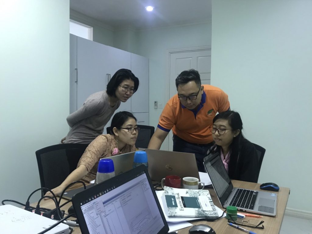
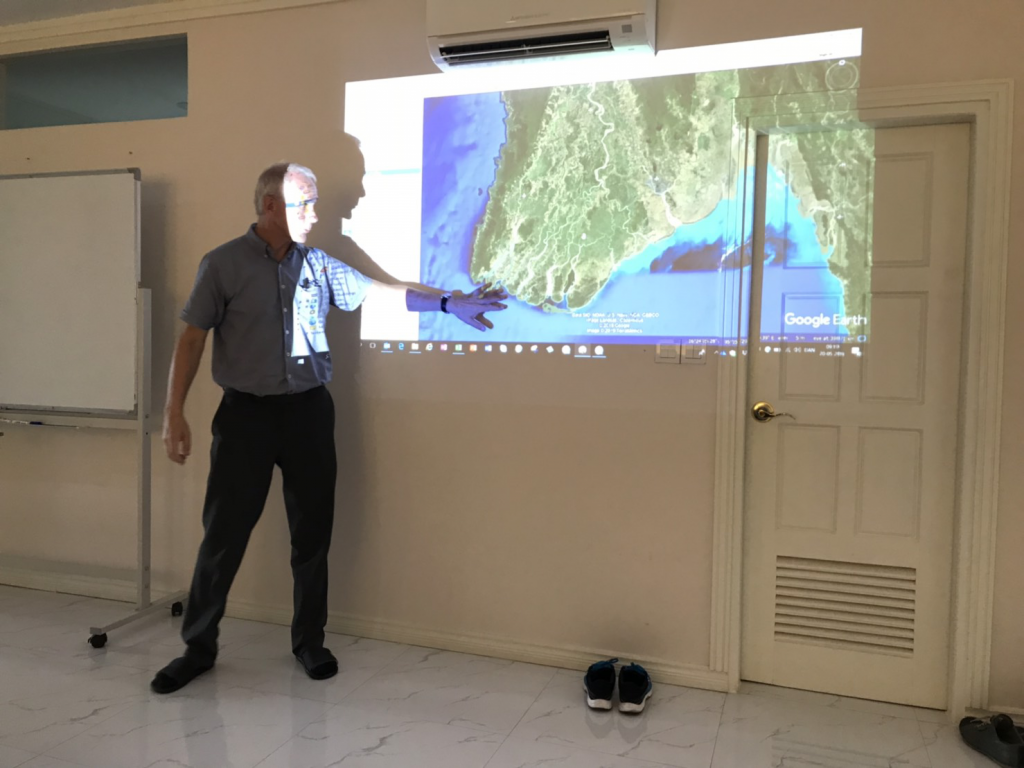
2.4 During 20-24 May 2019, HII joined the development of MIKE HYDRO RIVER in Ayeyarwady delta and MIKE HYDRO BASIN model in Ayeyarwady Basin. The model development has been divided into the following topics:
1) MIKE HYDRO RIVER MODEL in Ayeyarwady delta area
- Collect and analyze data for the development of MIKE HYDRO RIVER model in Ayeyarwady delta area
- Preparation of data for MIKE HYDRO RIVER model’s creation
- Create MIKE HYDRO RIVER model
- Analyze the result of the MIKE HYDRO RIVER simulation
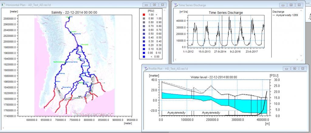
- Create the Salinity Intrusion Model
- Analyze the Salinity Intrusion Model simulation
- Set up scenarios into the MIKE HYDRO RIVER model such as:
– Water situation while there is a reservoir above the watercourse to push a saltwater down during the dry season
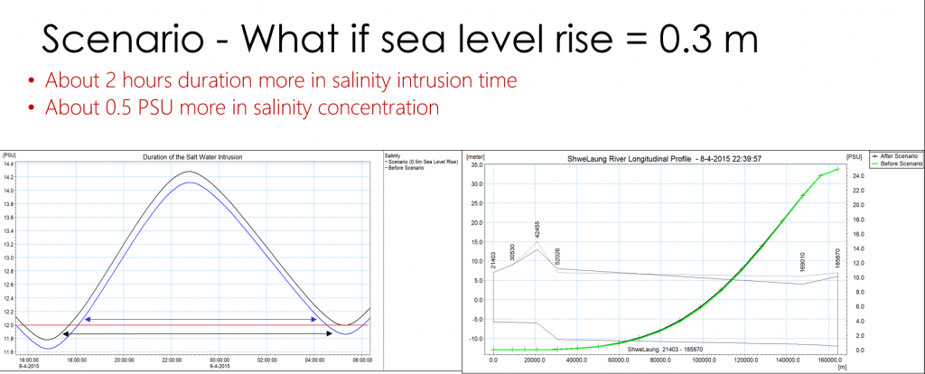
– Water simulation in case the sea levels are rising by 0.30 meters
– Water simulation in case there are floodgates to protect the saltwater intrusion in the Ayeyarwady River

2) The MIKE HYDRO BASIN model in Ayeyarwady Basin
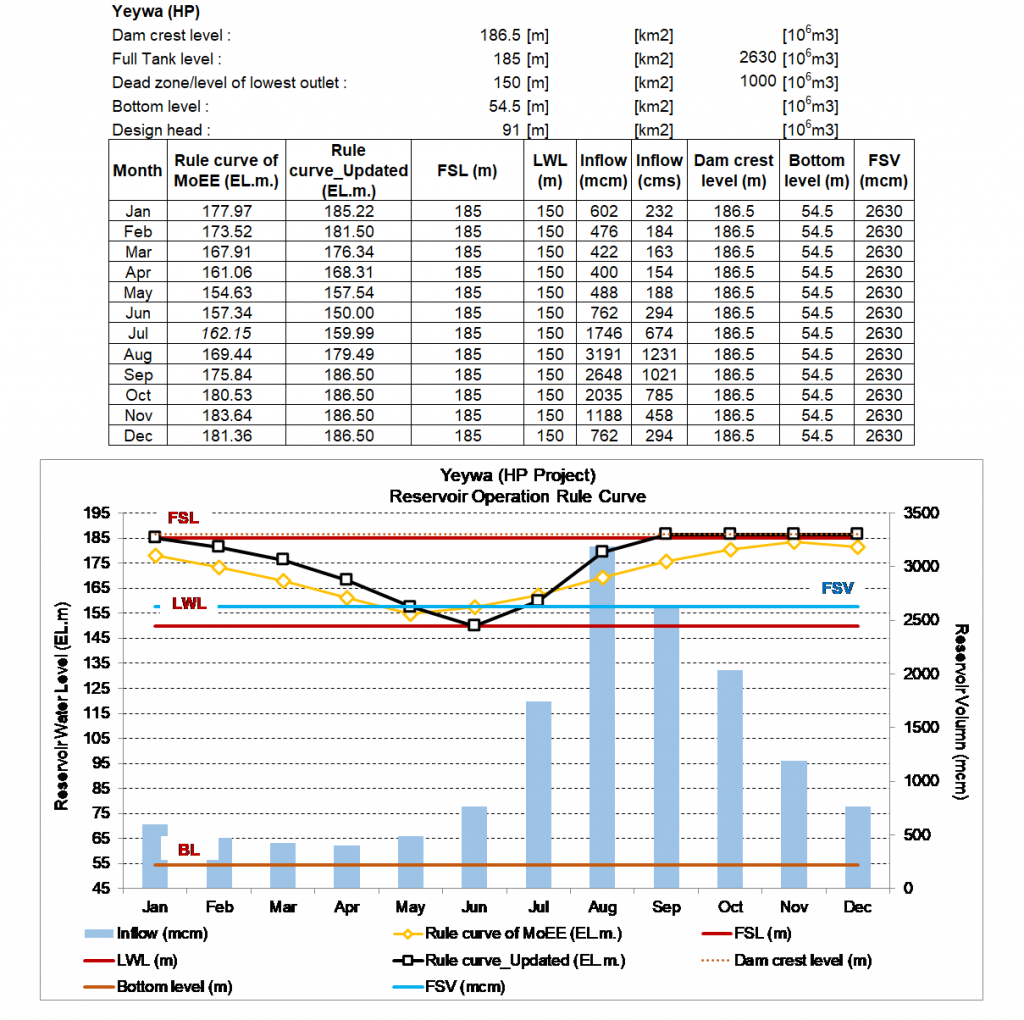
- Examine the accuracy of time series data for setting up MIKE HYDRO BASIN model of reservoirs e.g. level area volume table, characteristic levels, and flood control level
- Seek for the minimum release requirement of reservoirs to analyse and create reservoir’s ‘Rule Curve’ from either reservoir with rule curve or without
This activity resulted in a better understanding of the general conditions of the Ayeyarwady Basin e.g. physical and hydro-meteorological characteristics
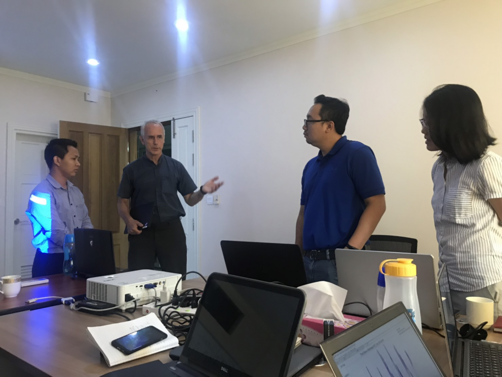
2.5 During 5-9 August 2019, HII joined as a trainers in the development of MIKE FLOOD model in Ayeyarwady delta area under the following topics:
1) The development of the MIKE FLOOD MODEL
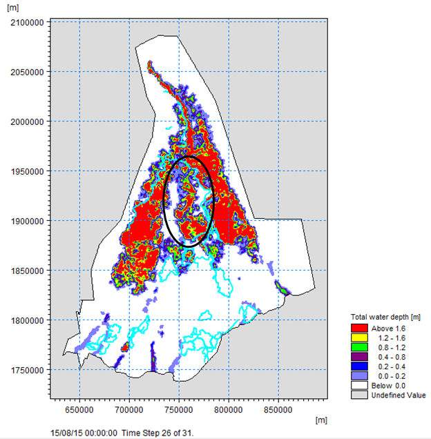
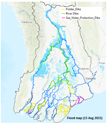
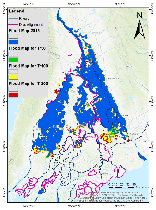
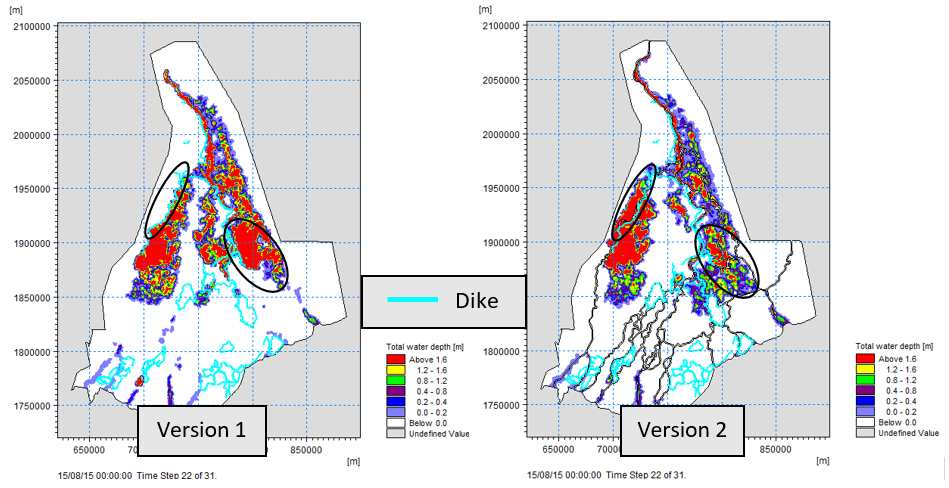
The MIKE FLOOD model was developed by DHI and enhanced by HII’s experts. HII compared the result of the model with the flood mapping using satellite images. The simulation results are not consistent with the measurement data because of the lack of dike in the model. After adding dike, the simulation result shows a more realistic outcome.
2) Flood Simulation
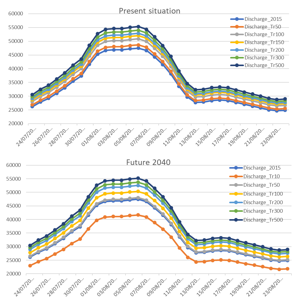
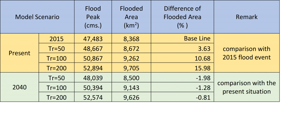
The model simulated the floods recurrence at 50, 100, 150, 200, 300, 500 years and simulated the future floods with a Hydropower project above the watercourses in the Ayeyarwady delta based on various recurrence periods.
3) The improvement of MIKE FLOOD model
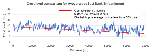
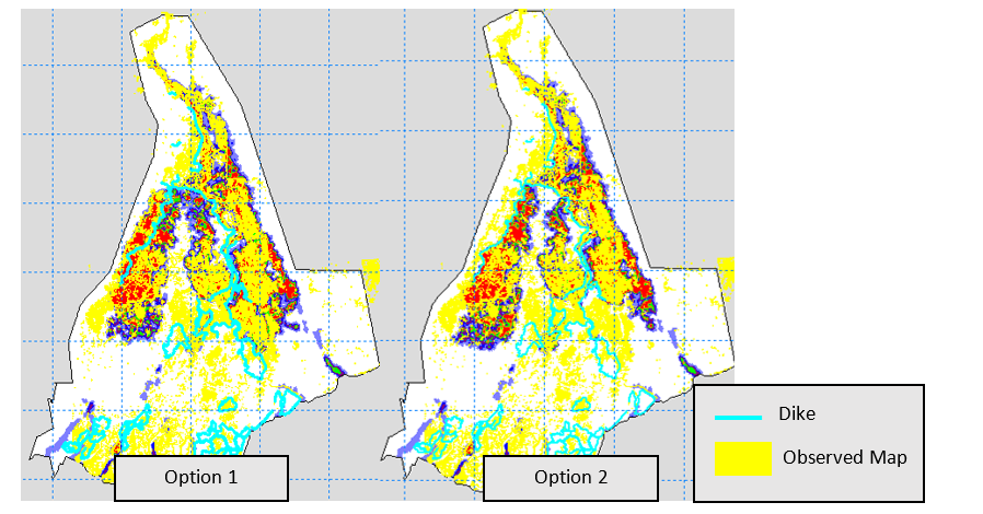
Since the first MIKE FLOOD model has not been appropriately linked between the MIKE HYDRO RIVER and MIKE21 models, the MIKE FLOOD model must be modified for more accuracy. After the improvement, the simulation of the flood map simulation shows closer results to the measurement data.
4) Training on the Utility of MIKE FLOOD model
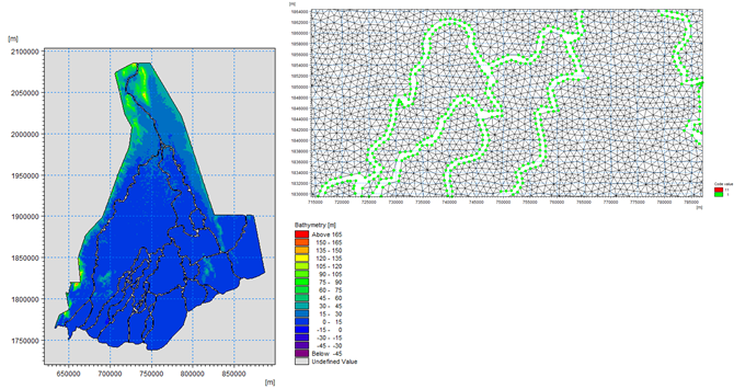
- The utility of MIKE21 model training
– Set up MIKE21
– Create Mesh Generator (.MDF)
– Set boundary and result
– Simulations - The utility of MIKE FLOOD model training
– Set up MIKE FLOOD
– Link MIKE HYDRO RIVER and MIKE21
– Create dike in MIKE FLOOD
– Simulations

The outcome of these events increase an understanding of the general condition of Ayeyarwady river basin and increase international experiences of HII’s experts.