
Surveying technology (Unmanned Aerial Vehicle: UAV)/ Autonomous Robot Boat/ Land Mobile Unit or Mobile Integrated Geospatial Intelligence System)
07/05/2020
HII has collaboration with academic institute to develop mobile surveying technology for monitoring, observing, and collecting air, ground, and water data for analysing water situation and supporting water resources management plan to optimum efficiency.

Unmanned Aerial Vehicle or UAV 
Autonomous Robot Boat for environmental observation 
Land Mobile Unit or Mobile Integrated Geospatial Intelligence System

Unmanned Aerial Vehicle or UAV
Unmanned Aerial Vehicle or UAV is a non-pilot aerial vehicle controlled by autopilot system from a long distance. It is used for various missions in difficult accessing areas. HII has collaboration with Institute of FIeld roBOtics (FIBO), King Mongkut’s University of Technology Thonburi (KMUTT) to develop UAV by ad่justing the shape and equipment in order to fit with observing tasks from long distances. The UAV also capable for taking picture and video from high angle. It is generally used in observing and estimating the situation in the area affected by natural disaster that is difficult to access by car or boat, moreover, UAV also capable for collection of geographic information for pre- and post- disaster situation.


The UAV can automatically fly to Way Point which is pre-set before taking off, and the controller can monitor its status from ground station via monitoring screen. The UAV is attached with observation tools that can record still and motion pictures along with GPS to memorize the coordinate of each photo. In case of emergency, UAV could head back to its base safely.


During major flood in 2011, UAV played very crucial role in widely monitoring affected areas, due to its capability in efficient access and consequently resulted in prompt response. The UAV was remote-controlled by the pilot from ground station via autopilot mode.
Autonomous Robot Boat for Environmental Observation
HII has collaborated with Department of Science Service and Rajamangala University of Technology Thanyaburi (RMUTT) to develop Autonomous Robot Boat which can measure river’s dimension, hydraulics indicator, hydrology indicators, and water quality indicator. The boat is designed in small size, however, capable to carry necessary tools, which helps reducing labors’ risk while increasing operation efficiency comparing to traditional observation method.


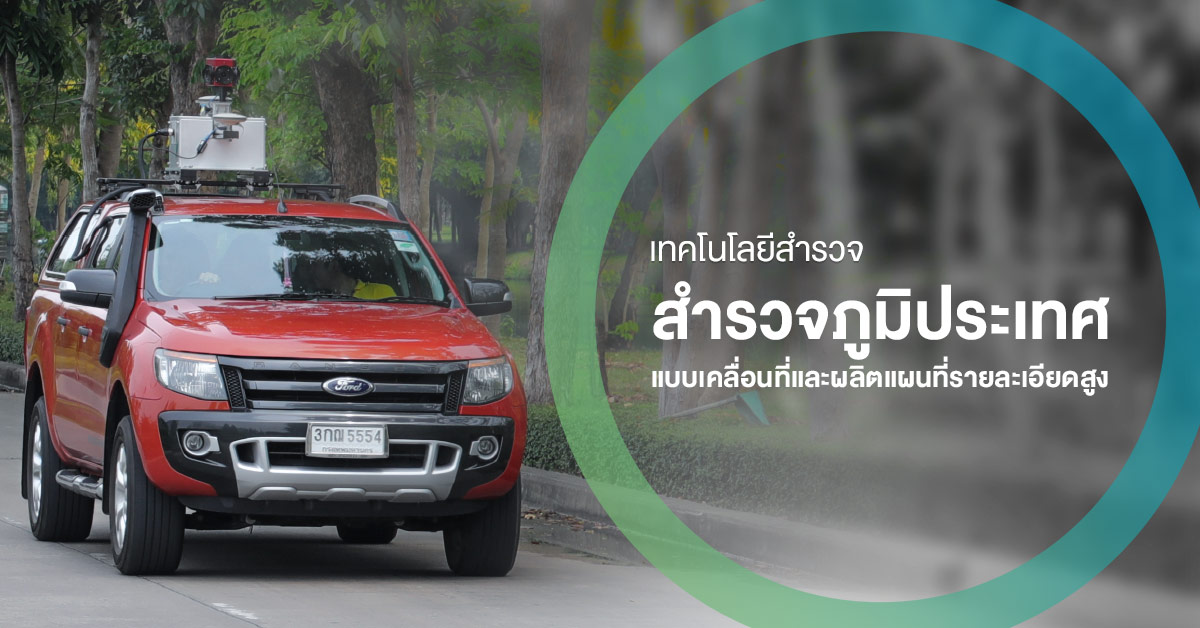
Land Mobile Unit or Mobile Integrated Geospatial Intelligence System
The car is used to measure terrain height, such as canal height, river bank, river ridge, road, and infrastructure of water station control. The data are essential for analysing process and plan for water management in normal and crisis situation.
HII has collaborated with Institut Cartogràfic de Catalunya (ICC) developed Land Mobile Unit which attached with Mobile Mapping System (MMS) by the application of GPS orientation and geographic sensor for detecting location of an object. It is accurately and applicable for geographic mapping process which indicates height compared with mean sea level.
The Mobile Mapping System (MMS) are comprised of:
- GPS orientation / GNSS Antennas / Inertial Measurement Unit (IMU) / SPAN Controller
- Geographic Sensor / Laser Measurement System / Visual Recording System