Drought Monitoring System
16/04/2020
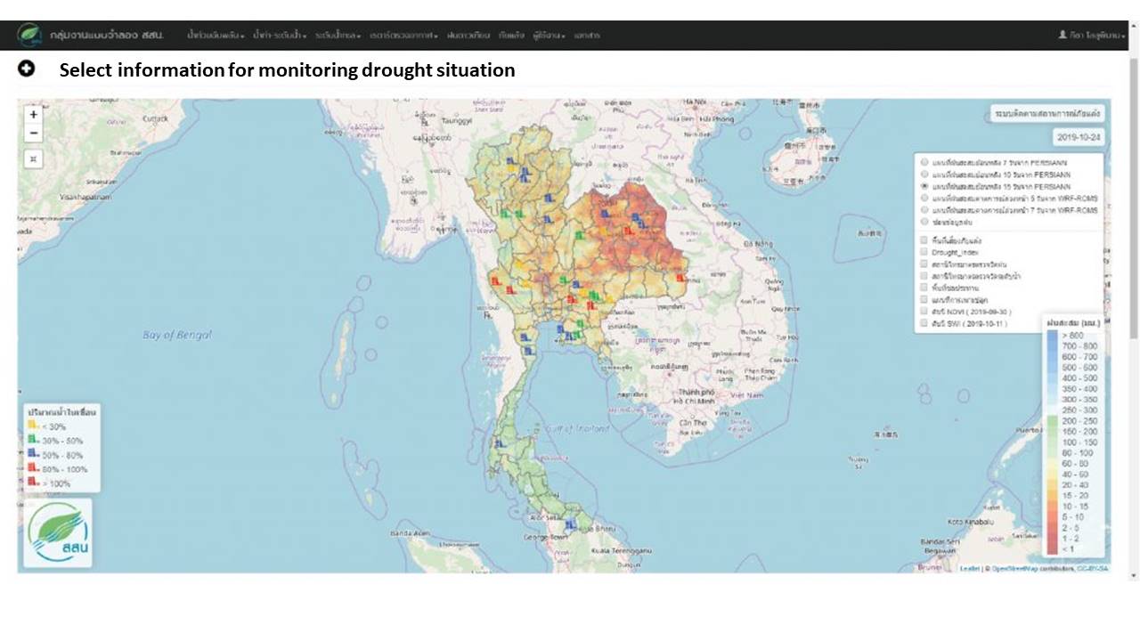
Drought Monitoring System is used to monitor meteorological drought situation by overlapping various data and factors to analyze the drought risk.
The Estimation of Drought Risk Area
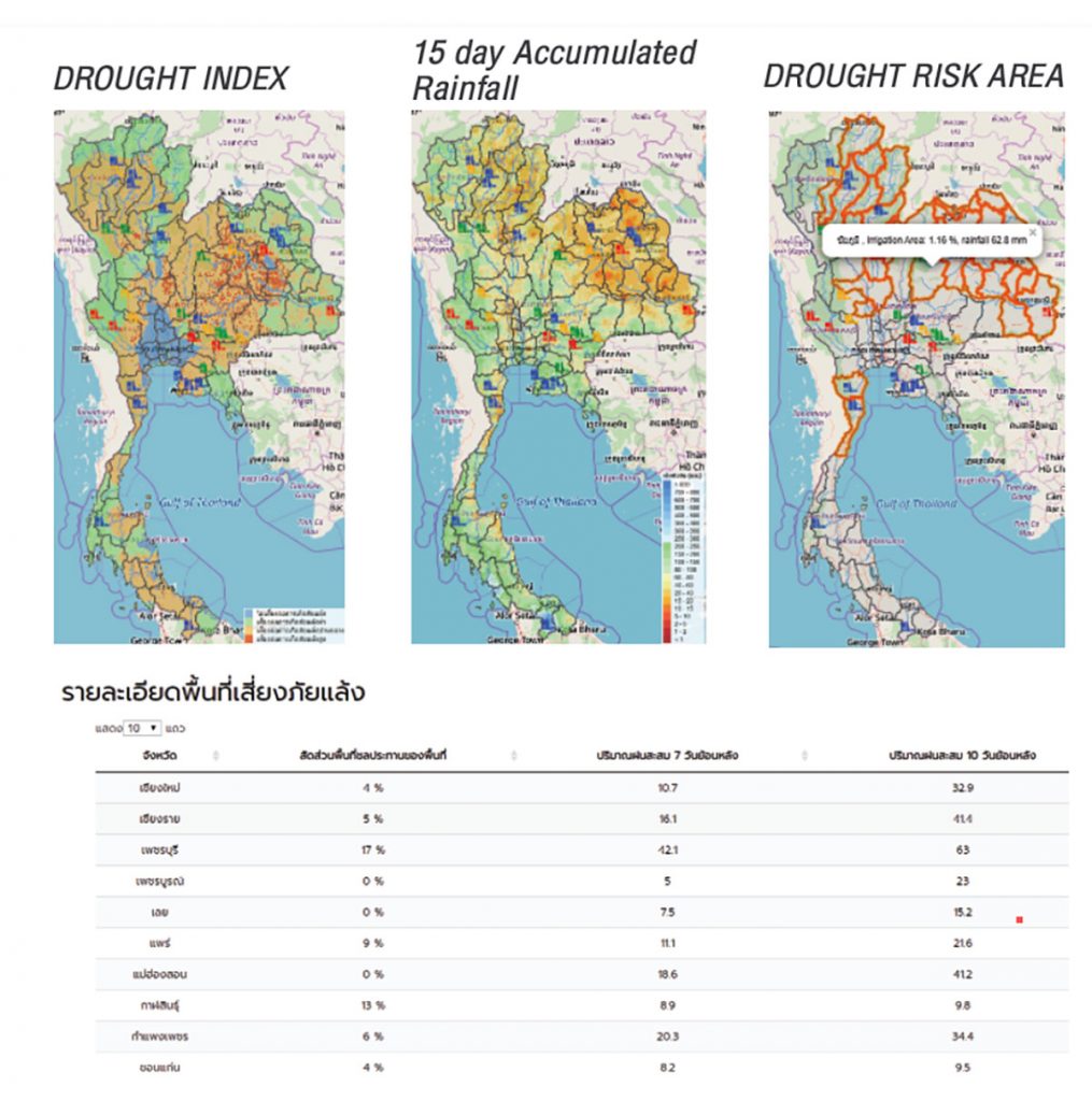
DROUGHT INDEX is calculated by scoring various factors as follows,
- The irrigation area from Royal Irrigation Department
- Average rainfall 30 years from Thailand Meteorological Department
- Repetitious drought area from Land Development Department
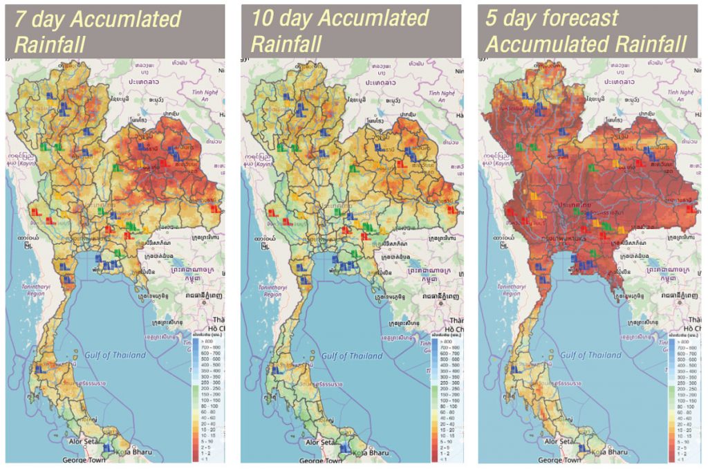
Accumulative rainfall 15 days from PERSIANN satellite (Bias-Corrected) was used to specify drought area from rain-shortage or rain recession.
Other factors
- Accumulative rainfall 7 and 10 days from PERSIANN satellite
- Accumulative rainfall forecasting 5 and 7 days from WRF-ROMS (Weather Research and Forecasting-Regional Ocean Model System) model
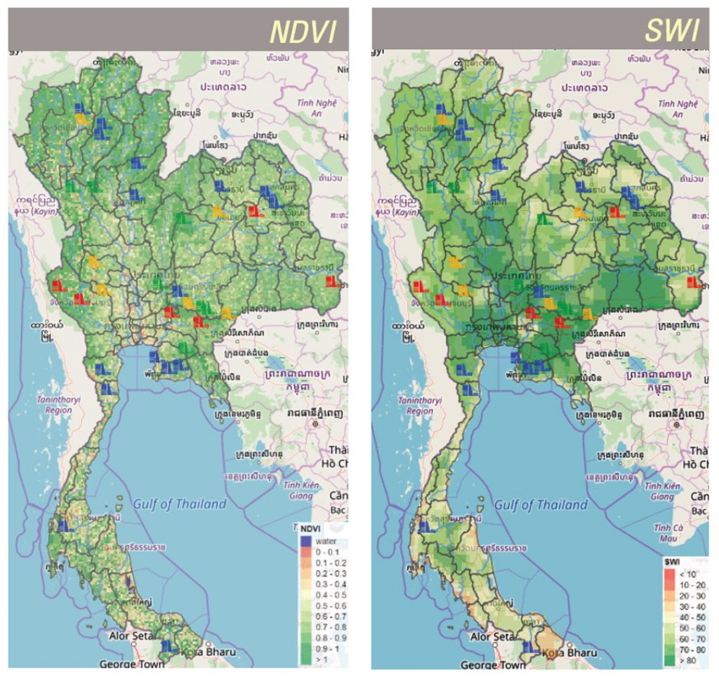
- Normalized Difference Vegetation Index (NDVI) 16 days from MODIS satellite
- Soil Water Index (SWI) from METOP-ASCAT satellite
- Dam level from Royal Irrigation Department