2018: The Development of a Mobile Surveying Technology to Support Monitoring and Analyzing of Water Situation
15/04/2020
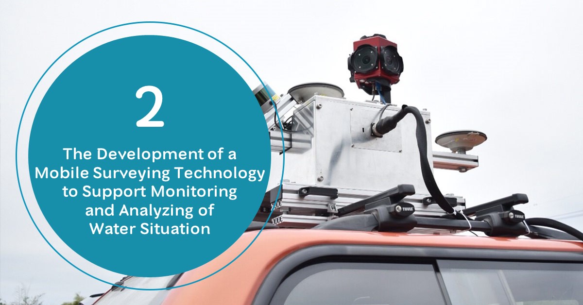
HII has developed a mobile surveying technology which is lightweight, precise, and easy to install on automobile, motorcycle, and boat. Also, HII has developed Unmanned Aerial Vehicle (UAV) for high-resolution mapping to cover large areas. This UAV can vertical takeoff in order to eliminate horizontally take off and precisely provide aerial information.
In addition, the project has integrated mobile surveying and UAV data, then visualized in 3D. Therefore, the development of various technologies is particularly important to facilitate the surveying to be more accurate, flexible, and fast.
The outcome from the project comprised of 3 components as follow:
1. High-performance geography mobile survey equipment
- Navigation and GNSS
- 360 degrees camera
- Dimension measurement
- Laser scanner

อุปกรณ์นำหล และ GNSS 
กล้องถ่ายภาพ 360 องศา 
อุปกรณ์วัดรอบล้อ 
Laser scanner
All devices are placed on the platform by calculating the equipment layout referring to international standards in order to get the highest accuracy
System accuracy
The system is Absolute Accuracy with Base Station on 3 tests. The accuracy is as follow:
Horizontal RMS 7 cm./ Vertical RMS 22 cm./ Relative Accuracy 3 cm.

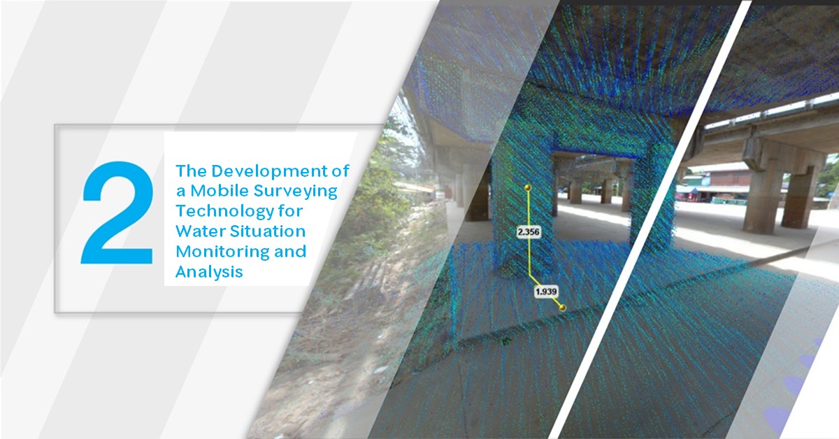
Canal width measurement at Chai Nat Province 
Canal width measurement at Chai Nat Province 
Dyke measurement (height) at Chao Phraya River, Nakhon Sawan Province
2. Vertical take-off UAV survey mapping


Picture from Vertical take-off UAV survey mapping
3. Controling and processing software


Summary
Mobile survey topography equipment on automobile, motorcycle, and boat can operate 2 hours continually with more than 35 cm. accuracy at 3 meters from the photo taken. (compared with Royal Thai Survey Department’s coordinates )
Vertical take-off UAV supported RTK or PPK system which can cover an area over 4 sq.km. per flight or 1 hour operation per trip, and can assess while testing the system. The data from UAV survey mapping has horizontal accuracy no more than 1 GSD and a vertical accuracy not more than 3 GSD. (compared with coordinate from Royal Thai Survey Department’s coordinates )
3-dimension visualization by using height and distance data from mobile survey topography and vertical take-off UAV.