Global Navigation Satellite System
23/04/2020
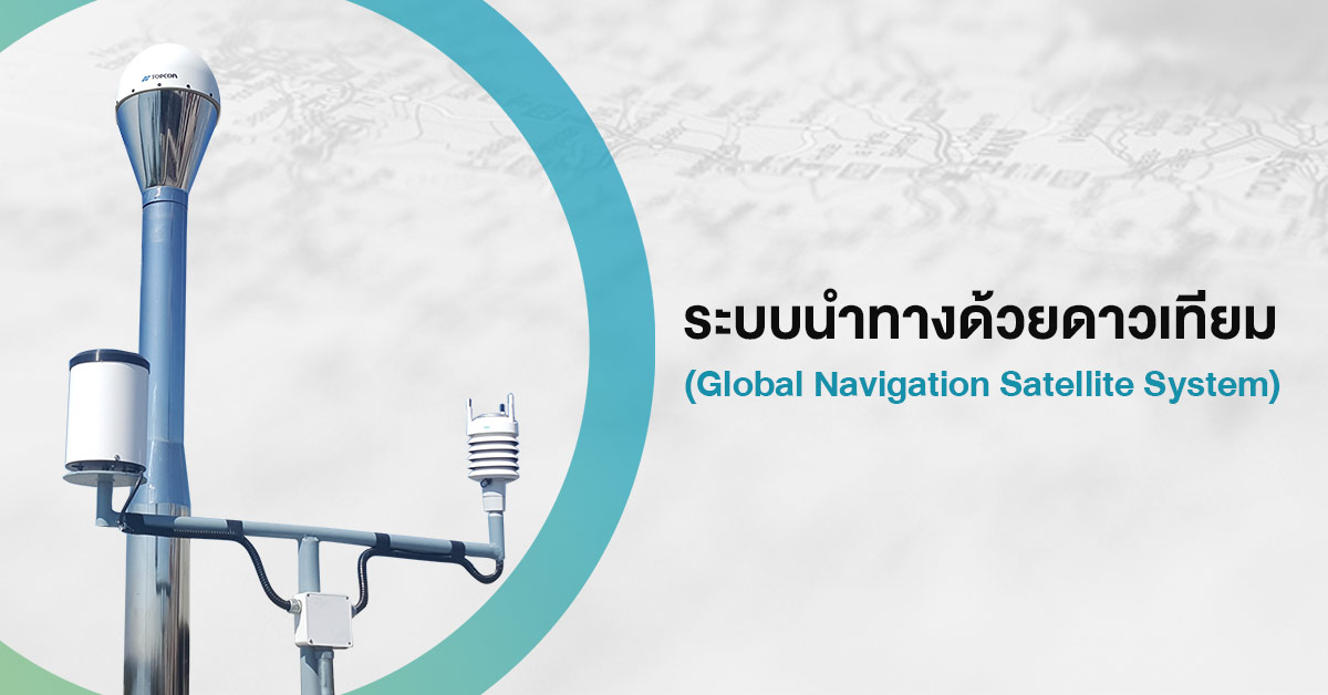
Global Navigation Satellite System (GNSS) is a system that uses satellites to provide autonomous geo-spatial positioning. It allows small electronic receivers to determine their location to high precision using time signals transmitted along a line of sight by radio from satellites. Currently, many satellite navigation systems have been developed such as GPS (USA), GLONASS (Russia), Galileo (Europe), BeiDou (China), QZSS (Japan), and SBAS.
Many developed countries have applied GNSS technology in order to support national development to maximum efficiency. By constructing GNSS Continuously Operating Reference Station (CORS) Network in Thailand, it will transmit the corrected data which result in highly precise positioning in a short period of time.
Operation process: GNSS CORS network
Hydro-Informatics Institute (Public organization) or HII under the Ministry of Higher Education, Science, Research and Innovation (MHESI) has collaboration with Department of Disaster Prevention and Mitigation under Ministry of Interior, and National Institute of Metrology (Thailand) under MHESI to establish “Global Navigation Satellite System (GNSS) Continuously Operating Reference Station (CORS) Network in the Risk Area Project” and install 6 CORS stations at Prachin Buri Province, National Institute of Metrology (Thailand), Samut Prakan Province, Ang Thong Province, Chachoengsao Province, and Nakhon Pathom Province. By this project, the risk area in central Thailand has been covered in order to monitor and provide precise water level information to support decision making in risk area.
GNSS CORS Coverage Area: Flood Prone Area in Central Thailand
Currently, HII has provided 2 data services:
- Real-time: Request to HII for a user license. Currently, Bangkok Metropolitan Administration, National Science and Technology Development Agency and Royal Thai Survey Department already involved in the real-time data service testing.
- Post-processing: provide service through web browser http://164.115.138.208:8080/geopp_gnweb/gnweb.html
Application of GNSS CORS and Country Development
In 2019, 222 GNSS CORS stations are installed with collaboration from Department of Lands, Department of Public Works and Town & Country Planning, Department of Disaster Prevention and Mitigation, National Institute of Metrology (Thailand), and Hydro-Informatics Institute (Public Organization). Its coverage are now country-wide.
The land survey data derived from GNSS CORS are relatively high accuracy. The positioning, level, and atmosphere data are of versatile use. It can be applied in developing surveying system, research services, and build on various important development e.g. cadastral survey, public utility and building design, high-precision mapping, agriculture, transportation, natural resources management, disaster management, and etc.